The Watcher in the Allgäu:discovering Bavaria's Grünten mountain
Excursion to the Allgäu
CONTENTS:
THE PEASANT’S ASCENT
We met up at the trailhead in Burgberg, Bavaria – a small group of outdoor-loving Addnature crew; slightly bleary-eyed from the early start but giddy to get going. After brief but friendly introductions I asked which of the blue mountain shapes on the skyline we’d be tackling today. I was confidently informed that our target: the ‘Grünten’, lay behind. This 1737.9m peak sits on the edge of the Allgäu Alps; which is why it’s also known by a name that sounds plucked from the pages of a Tolkein novel: the ‘Watcher’.
I’d found a sturdy walking stick discarded at the beginning of the path – either by nature or a previous kind-hearted hiker – and was pleased to feel its solid resistance when I tested my weight on it. And so, we started up, up, up; following pebbly path through flame-coloured woodland and over gnarled roots; almost scrambling over rocky patches at points. As we went, I thought enviously of the far lazier summit tour of Augsburg Prince-Bishop Clemens Wenzeslaus. In 1773, His Highness was carried to the top in a padded carrying chair, by no less than 56 farmers! But in the absence of dozens of helpful farmer folk, I tried my best to quieten my mind and instead filled my lungs with deep breaths of spruce-scented air.
Eventually, I settled into an upwards rhythm and started to enjoy the stretch in my legs and gentle breeze on my face. Mist and rain kept us cool and hushed. Instead of chatting, we had to focus our attention on the slippery subsoil and rolling stones beneath our feet.
MONUMENTS & MOUNTAIN TOPS
Finally, we cleared the treeline – which left us with a fairly short stretch of relatively easy, winding path before we hit our first scheduled breakpoint: the Grüntenhaus, at around midday. That same thick mist that had provided cooling relief on the way up robbed us of the view I indignantly felt we’d earned. But, the thought of hot tea (and something more substantial than the nuts we’d nibbled on the go!) softened the blow. Local eintopf (a traditional stew) with delicious chewy spätzle was the order of the day. Hikers’ dogs shot us envious looks. I didn’t blame them.
After stomachs were satisfied we were unwilling to waste much more of the day, so we rallied and set up the snaking road that leads to the top. After you’ve reached the Grüntenhaus, it’s just a couple of hundred vertical metres before you reach the main summit: the Übelhorn. Newly refuelled and refreshed I practically bounded up this stretch of ascent.
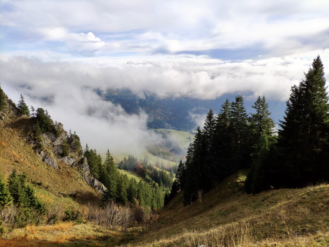
The Gebirgsjäger monument at the top is dedicated to German mountain troopers killed in action. We took pictures in the eerie fog that clung to it and the rest of the mountain top; whilst admiring the scraps of dramatic landscape that were still visible: rocky outcrops and picturesque evergreens precariously clinging to their sides. The mountain was named for its stark, rocky peak – the result of mining activities in the area from 1471 on – which left much of the region stripped of wood. So, it’s no surprise that the name ‘Grünten’ means "bald head" (Grind) in the Allgäu dialect.
DOWNHILL FREEDOM
From here on in we’d get our first taste of descent. This exposed summit presented a steep path ahead. The rain hadn’t been our friend on this terrain – creating slick sections that teamed up with roll-happy scree and threatened to bail us over the edge. I braced my trusty stick between myself and the side, optimistically confident in its ability to protect me from the sheer drop below.
After a while, the path bottomed out and we hit lush grasslands. This coincided with the sun breaking through the last, light cloud that remained above us. The sunshine warm on my face and joy bubbling in my stomach, I felt a lightness that I definitely hadn’t felt on the way up! Scanning the trails snaking before me in this beautiful landscape, I felt the urge to run. Picturesque path? Check. Dry but challenging terrain? Check. Beautiful scenery and fresh air? Check, check, check. I let the group know I’d be heading ahead and set off into a light lope, wondering to myself: why exactly does running downhill feel so good? I forgave the mountain for the harsh trudge on the way up and lost myself in the action instead.
I continued this way for a while; stopping periodically to wait until I saw another member of the group silhouetted against the horizon. Entering the treeline, I admired alien-looking funghi birthed on wet wood stumps as they flashed by; my footfall pushing me on. Eventually, the woodland thinned once more and I cannoned right out of the trees and down onto bouncy, grey asphalt. The road marked the end of the mountain section of the route we’d planned. So, I regained my breath and lazily stretched whilst waiting for the rest of the group to catch up.
AS THE LIGHT FADED
After a brief pause, we all set off on the home stretch. Reaching a forked road, we opted for the longer, scenic route: towards Starzlachklamm: a series of wooden walkways and gridded bridges winding through a dramatically beautiful gorge. By this point we were approaching sunset, and as the light faded we became aware that heading through dark woodland without headlamps or torches wouldn’t be the best of plans. So, we pushed the pace up a couple of notches and reached the van meetup point at 7 pm – just as the last of the light blinked out.
We finished the hike with mixed emotions: happy to have achieved the challenge, but sad to see it end. It was a comfort to know that future hikes were already being planned. Bis dann fellow adventurers.